
Ticket #177 (new bug report)
wrong segment selected
| Reported by: | milovanderlinden | Owned by: | somebody |
|---|---|---|---|
| Priority: | major | Milestone: | |
| Component: | Dijkstra | Version: | |
| Keywords: | Cc: |
Description
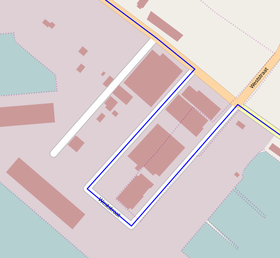
Hi there! I am setting up pgRouting with openstreetmap data. I have something odd. (See screenshots) I have two nodes in my network that are connected by two lines like this:
| | | | | | | | | | -----B-----
I use both cost and revers cost, but no matter how high I set the cost for edge B, it refuses to return edge A in a routing request.
The live example is here: http://dogomaps.net/yours/test.html?flat=12.521319256979&flon=-70.041577813017&tlat=12.519669651038&tlon=-70.039394494879&v=motorcar&fast=1&layer=mapnik
Can it be that it does a select limit 1 under water or something that in my case always returns the wrong one?
Attachments
-
osm-screenshot.png
 (70.0 KB) - added by milovanderlinden
14 months ago.
(70.0 KB) - added by milovanderlinden
14 months ago.
- Route selected by pgRouting
-
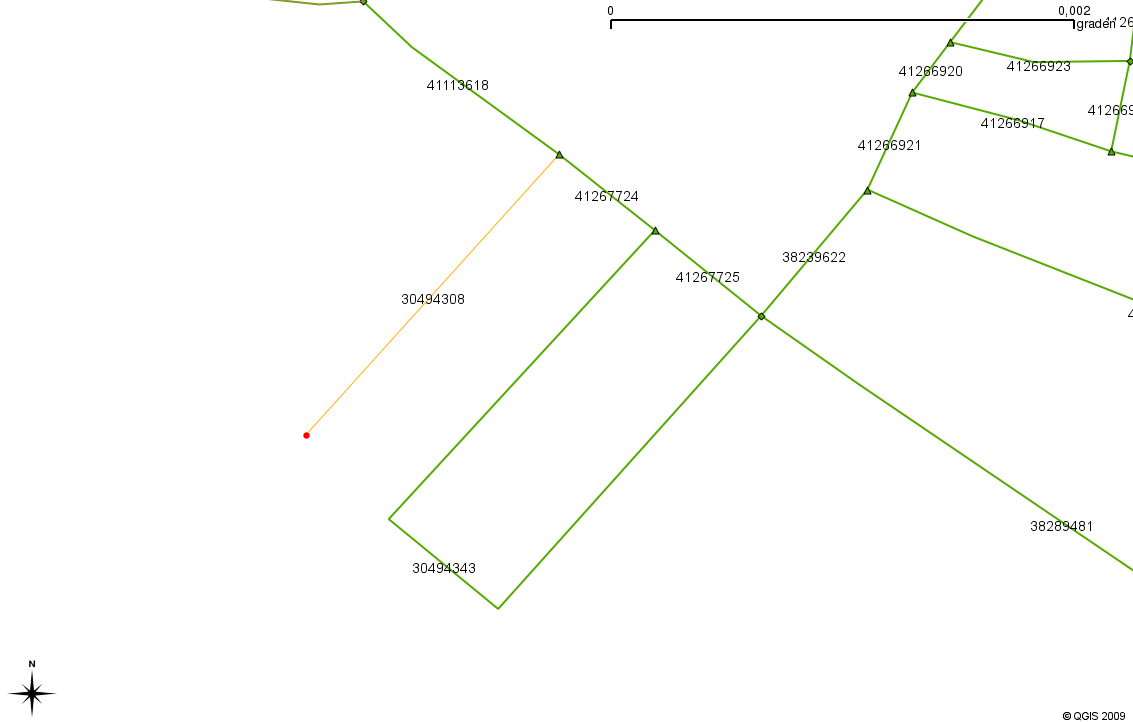
qgis-screenshot.png
(69.7 KB) - added by milovanderlinden
14 months ago.
- topology in qGIS, the symbol represents the number of connections to the node (triangle=3, square=4)
-
osm2pgrouting.sql
(3.6 KB) - added by milovanderlinden
14 months ago.
- Script to create tables from the openstreetmap tables for routing
Change History
Note: See
TracTickets for help on using
tickets.